Academic research on the Great East Japan Earthquake and Tsunami
Organization: International joint survey group organized with the Japan Society of Civil Engineers playing a leading role
A detailed scientific survey of the Great East Japan Earthquake and Tsunami of March 2011 was conducted, which allowed us to investigate a full picture of the mega-tsunami. This survey promoted academic studies on the topic to be advanced and various plans for recovery and reconstruction to be formulated. The importance of tsunami disaster reduction has been reconfirmed around the world, leading to the establishment of World Tsunami Awareness Day (November 5).
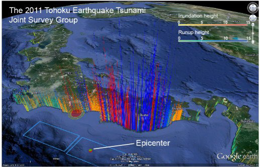
(seeing East Japan from the Pacific Ocean)
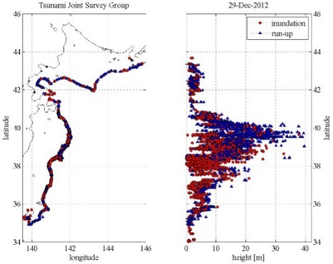
(where blue corresponds to the run-up height
and red corresponds to the inundation height)
Contributing to coastal disaster prevention with the provision of detailed information on ocean currents and seawater temperatures
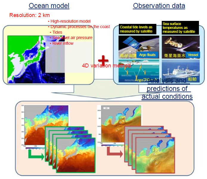
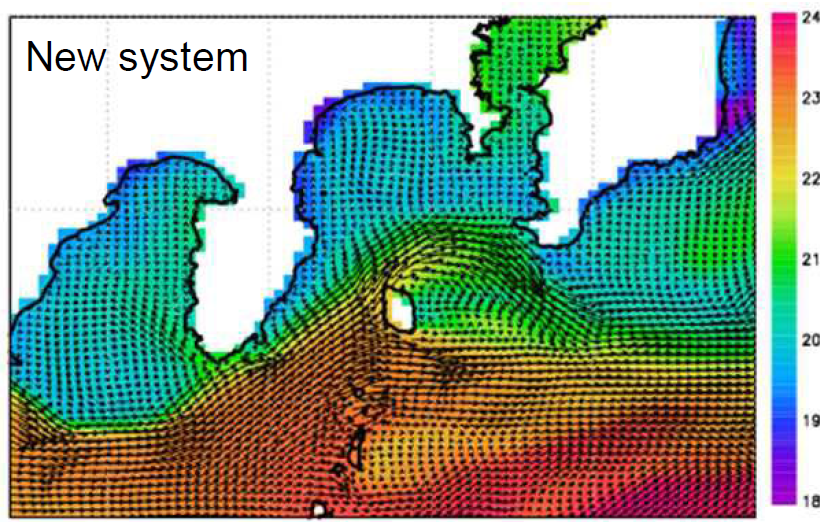
The Japan Meteorological Agency developed a new operational system for monitoring and forecasting coastal and open-ocean states around Japan (MOVE/MRI.COM-JPN (JPN System)) in order to provide more detailed ocean current and seawater temperature in coastal areas and open-ocean. Whereas predictions of ocean currents and sea temperatures used to be made with a ten-kilometer grid, the JPN System allows for predictions to be made at a higher resolution of two kilometers. The ability to make detailed predictions of changes in ocean currents and sea temperatures in coastal areas around Japan now makes it possible to predict changes in coastal tide levels caused by ocean conditions.
In conjunction with the start of the operations of the JPN System, the Japan Meteorological Agency will work to improve information concerning unusually high sea level and provide information to facilitate the use of detailed data on currents and sea temperatures.